InSAR-derived Ground Motion
Product Description
The Earth’s surface is in constant motion. Whether due to natural phenomena such as tectonic activity or volcanism, or because of human activities such as groundwater extraction or mining, the dynamism of the surface can have significant impacts on infrastructure and natural ecosystems. In recent years, increasing awareness of the potential risks related to ground motion has led to a demand for comprehensive and reliable information on these movements.
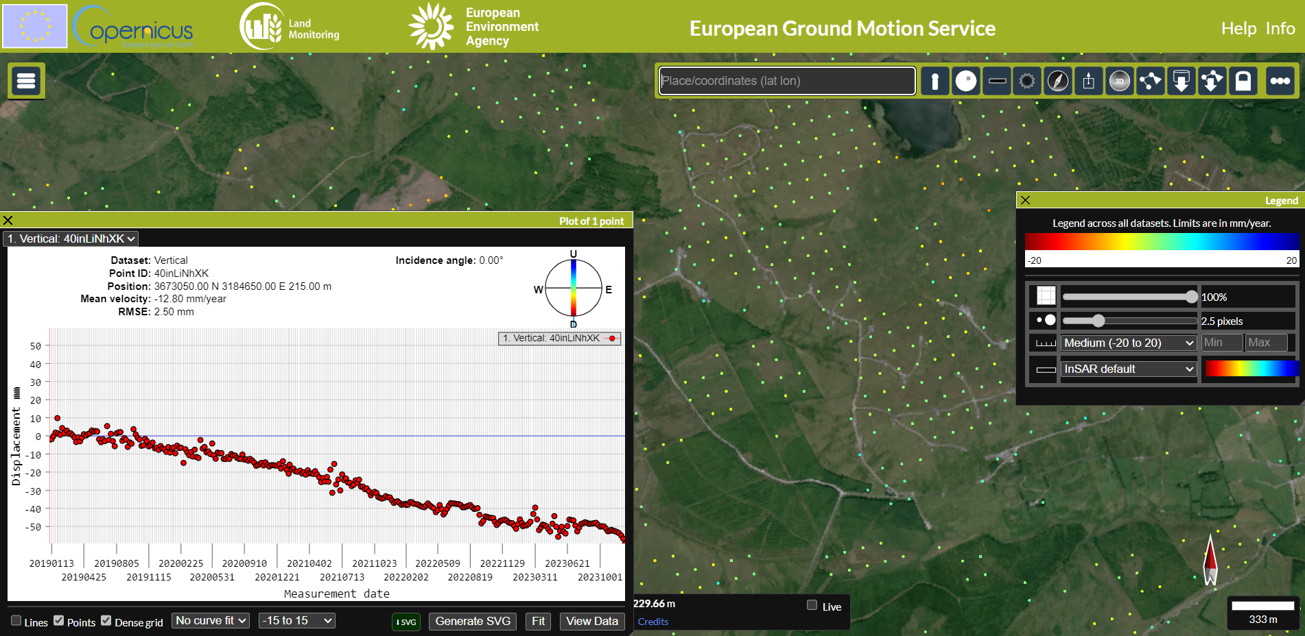
This capability uses Synthetic Aperture Radar Interferometry (InSAR) data to detect and measure ground movements millimeter precision. City, regional, or state authorities can use it to monitor the structural integrities of dams, bridges, railways, and buildings. It allows urban planners to make data-driven decisions about where to build new infrastructure by assessing the likelihood of natural hazards such as landslides or subsidence. Researchers can also use this data to study the impacts of climate change, such as thawing permafrost and coastal subsidence.
This product has the potential for use within the wind sector. There are many cases of landslide occurrences the sites of onshore wind farm developments, leading to destruction of natural landscapes, contamination of nearby rivers, and in some cases, the loss of human life.
- Viking wind farm, Shetland, Scotland: https://www.scotsman.com/news/viking-wind-farm-shocking-footage-shows-turbulent-river-of-peat-as-landslide-strikes-near-giant-shetland-wind-farm-4622832
- Donegal, Ireland peat landslide: https://www.bbc.com/news/uk-northern-ireland-foyle-west-54994865
- Derrysallah wind farm landslide resulted in a fatality: https://www.irishtimes.com/news/crime-and-law/man-dies-in-suspected-landslide-at-wind-farm-in-co-sligo-1.2903750
Synthetic Aperture Radar (SAR) data:
- Sentinel-1
- TerraSAR-X
- COSMO-SkyMed
Future Mission Capabilities
ROSE-L

Planned for launch in 2028, Radar Observing System for Europe in L-band ( ROSE-L) is an Earth observing synthetic aperture radar (SAR) mission, being developed by the European Space Agency (ESA). The capabilities of ROSE-L will allow ground motion monitoring to be enhanced by using longer wavelengths than Sentinel-1 to penetrate vegetation cover.